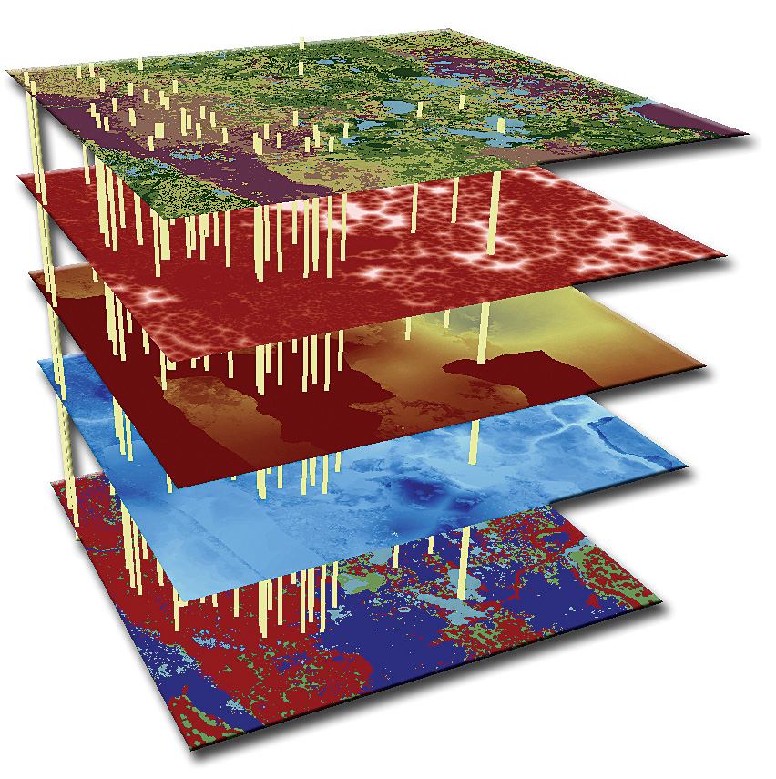
Watershed Assessment Modeling
SWET offers an array of modeling services, but are the world experts in the development and use of the Watershed Assessment Model (WAM). WAM is a Geographic Information System (GIS) based model that allows engineers and land use planners to interactively simulate and assess the the water quality of both surface water and groundwater based on land use, soils, climate, and other factors. This has included the environmental effects of various land use changes and associated land use management practices. The model simulates the primary physical processes important for watershed hydrologic and pollutant transport.
WAM was developed by SWET and has been in use by both private and public sectors for over 15 years. Please refer to the projects page to review how WAM has been applied in various watershed studies around the globe. Additionally, a section of the website is reserved solely for WAM related information. Please consult this for current news on the model, to download the software, access the on-line help or as a portal for technical support.
Hydrologic and Nutrient Model Development and Customization
Models are typically created for general use in academic or government agency settings. However, these do not necessarily represent the specific needs for each client. Our ability to customize a wide variety of models for a specific set of conditions allows for scientifically-based adjustments to better represent the physical systems being modeled. These adjustments and modifications can greatly increase the accuracy of the model.
Our reputation for understanding the physical systems in water resources, and developing state-of-the-art models, provides assurance of the increased accuracy and value our clients receive from our services. Increased accuracy introduces smaller bounds of uncertainty, and can lead to more convincing cases in permit review and hearings, or a more tightly defined conceptual plan to decrease construction costs.

The SWET team is composed of internationally-known modelers of water quality, water quantity, and economic impact. Members of our team have developed or created major modifications for several computer models, including:
- EAA-MOD
- EAA-FARM
- EAA-FIELD
- HWT-MOD
- LOADSS
- CREAMS-WT
- FHANTM (a modified DRAINMOD)
- BASIN
- BNZ (BASIN-NEW ZEALAND)
- SRWAM
- SJRWAM
- WAM
Geographic Information Services
SWET has been working with Geographic Information Systems (GIS) since its development in the early 1980's, through the development of the Watershed Assessment Model (WAM). The first WAM GIS based interface was developed before commercially available GIS software was even available, which resulted in SWET developing its own version of a GIS. SWET has moved on from then, and is fully compliant with the latest advances in all geospatial technologies including GIS, GPS, and Remote Sensing platforms.
The SWET team has unique experience in combining the capabilities of both vector and raster spatial datasets, tabular databases, spreadsheets, and programming languages into a powerful combination to allow user friendly modeling, enhanced analysis and impressive report generating capabilities, including professional cartographic products.